
I’ve always viewed technology as an enabler… and it can help here as we look to map the biodiversity of the landscape…
The principles of modern permaculture design* offer us an amazing resource as we set out to understand how best to work with the landscape… Part philosophy, part recently defined earth science, its practice is…clearly an age-old process…

This rare and treasured golden parchment is a map created by an Amazonian tribe I worked with called the Tiriyó of Kwamalasamutu. It’s an emotive key to understanding the intimate relationship that forest peoples have with their surroundings…..

Each bow and arrow, bird, snake, swirl and animal form, communicates ancestral knowledge and the tribe’s historical use of the landscape. It took years of painstaking effort to make and is one of the most beautiful and thought-provoking maps I have ever seen… an unforgettable source of inspiration.
As a Fellow of the Royal Geographical Society, I have always looked to technology to help map, enhance and better communicate the world around me.

Drawing on the past and calling on local knowledge, we hope to bring this landscape to life not just literally… but digital as well. And it all starts with mapping.

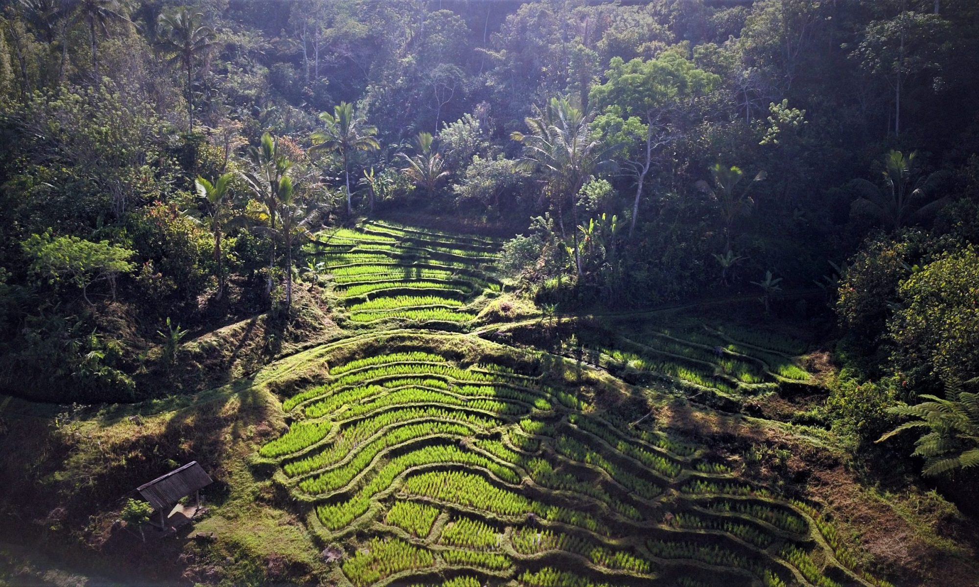
 Our original survey took three days and saw four people clambering through the bush with altimeters and GPS. Hi-tech for around here. The resulting, standard but inspiring, 2D map complete with elevations, taught us scale and form but not much else.
280- Meters from top to bottom (East to West). Rising 70 Meters in elevation. 100 Metres wide (North to South).
Enough to define the land in legal parameters. layering the vector image into Google Earth brought it to life a little…
As we look to create a truly cutting edge permaculture design* for the area, we will be calling on some seriously impressive tech to help enhance the details and help tell the story…. creating 3D photogrammetry with Dronedeploy, rendering within these digital landscapes interactive AR assets. Sounds hi-tech right. It is, but for the most part achievable with a few well-chosen apps and the latest mobiles. I’ll be sharing examples as soon as we can set to work.

Sharing the beauty of this place and the works underway.
It’s ambitious for sure but we know how it’s done. Over time, our working maps of Elsewhere will evolve into immersive, interactive experiences. Meaning a digital version of our landscape will be online in 3D and designed to engage and inform people through VR and AR headsets; wander through the forest at Sunrise or immerse yourself in the excitement of breathless trek up the volcano… there’s an exciting educational aspect to all this, so we will be looking at ways to inspire young minds.
A dream perhaps but a pretty amazing by-product if we can make it happen!
Want to help; get in contact
*Permaculture Principles & Design: The term ‘Permaculture’ was coined by Bill Mollison and David Holmgren in 1978. Definitions will vary but to me, It is the process of defining, harnessing and enhancing natural ecosystem dynamics in the context of human agriculture. With sustainability at its core, It involves the mapping of natural systems and the gilding of complementary floral (and fauna) to create the optimal return, in the form of both yield and growth. Its is a philosophy that combines natural balance and efficiency…